File:Last glacial vegetation map.png
Jump to navigation
Jump to search
No higher resolution available.
Last_glacial_vegetation_map.png (782 × 477 pixels, file size: 87 KB, MIME type: image/png)
Summary[edit]
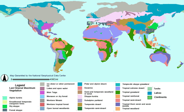
Reconstructed vegetation cover at the Last Glacial Maximum period ~18,000 years ago, describing the type of vegetation cover present, based on fossil pollen samples recovered from lake and bog sediments from the wikipedia page for Last glacial period.
Licensing[edit]

|
Mr. T says: "This image is in Public Domain. Use it for whatever you want, foo'!" |
File history
Click on a date/time to view the file as it appeared at that time.
| Date/Time | Thumbnail | Dimensions | User | Comment | |
|---|---|---|---|---|---|
| current | 20:53, 13 August 2016 | | 782 × 477 (87 KB) | Irritable of contents (talk | contribs) | Reconstructed vegetation cover at the Last Glacial Maximum period ~18,000 years ago, describing the type of vegetation cover present, based on fossil pollen samples recovered from lake and bog sediments from the wikipedia page for Last glacial period. |
You cannot overwrite this file.
File usage
The following file is a duplicate of this file (more details):
- File:Last glacial vegetation map.png from Wikimedia Commons
The following page uses this file: